Where is Machu Picchu from Cusco? About 80 km (50 miles) northwest, in southern Peru’s Cusco Region, with no direct road: you arrive by train and bus, or on foot.
Most planning mistakes start with a wrong mental map, such as a ruin on the edge of Cusco, a road to the gate, or a town that is the site itself. Each of these changes how you book. For wider context on where this sits among trips of its kind, see our guide to the best adventure travel destinations.
Where Machu Picchu sits
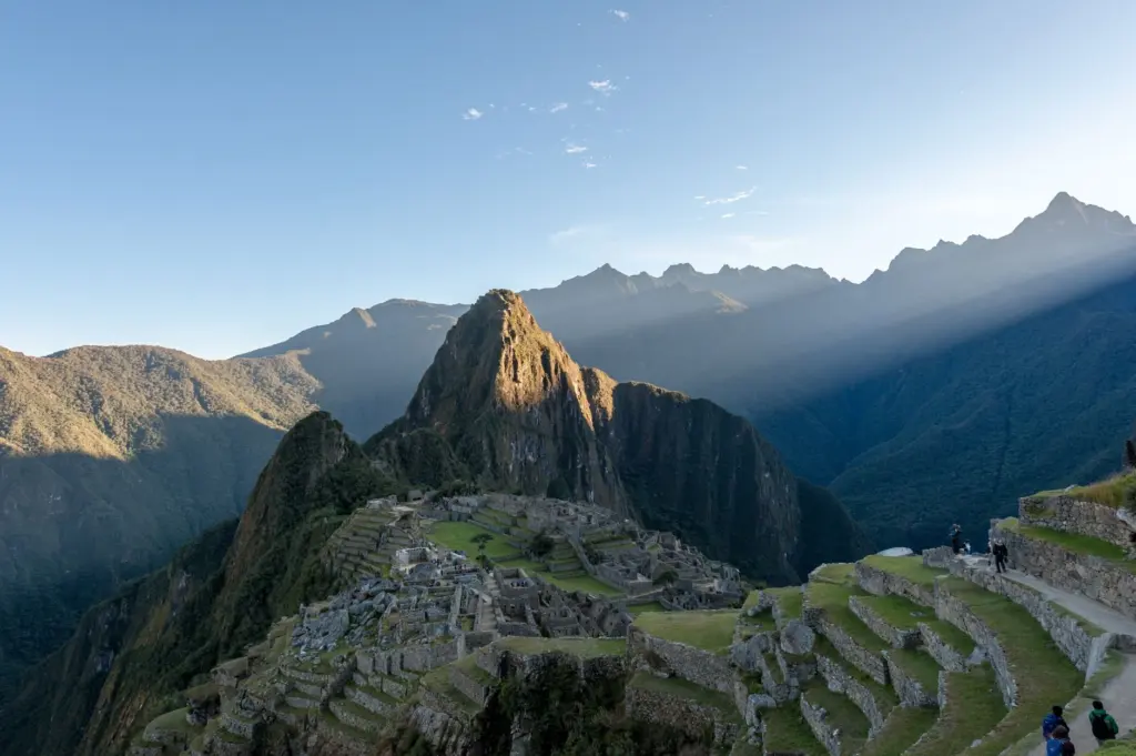
Machu Picchu is in the Cusco Region of southern Peru. Travel guidance places it in the Machu Picchu region of Urubamba province, with the ruins resting on a hilltop above the Urubamba River valley. The city of Cusco is the usual starting point, but the site belongs to a different valley system from the city.
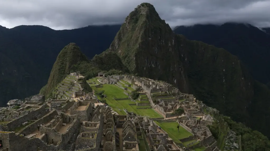
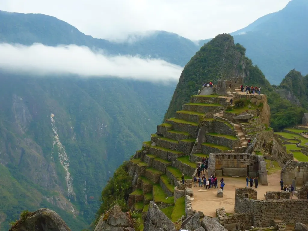
The official Machu Picchu site describes the natural setting as the eastern slopes of the Andes, encompassing the upper Amazon basin. It gives the elevation as 2,430 m above sea level, in the middle of a tropical mountain forest. That combination explains the terrain: steep forested slopes, a river far below, and no easy way to run a road up to the ruins.
Common misunderstandings about getting there
The table below sets the most frequent assumptions against what travel guidance says, so you can fix the picture before you book anything.
| Assumption | What is actually the case | Planning use |
|---|---|---|
| Machu Picchu is in Cusco city | It is in Urubamba province, about 80 km (50 miles) northwest of Cusco | Treat the journey as a full transfer, not a city excursion |
| You can drive to the entrance | The mountainside location rules out straightforward road access; you travel by train to or from Aguas Calientes | Book the rail leg first, because everything else hangs on it |
| Aguas Calientes is the ruins | It is a town with hot springs and a small souvenir market, a 30-minute bus ride from the site entrance | Plan lodging and meals there, then a separate trip up to the site |
| Only trekkers can walk in | Anyone fit enough can hike a marked jungle trail from Aguas Calientes, estimated at 90 minutes to two hours | Keep the walk as an alternative if you dislike queuing for buses |
Figures come from Voyagers Travel and Natural World Safaris.
Three corrections matter most in practice:
- Distance is not travel time. The straight-line figure from Cusco sounds short, but the route runs along a valley and ends with a mountain bus or climb, so allow a full day for the transfer rather than a quick hop.
- The town and the citadel are separate stops. Aguas Calientes also has hotels and restaurants, which makes it the natural base. The ruins have their own entrance a bus ride or hike away.
- Walking times vary by estimate. One source says about 1h30 on the marked trail, another says 90 minutes to two hours. Plan for the longer figure if you are not a fast walker or are still adjusting to altitude.
Routes in from Cusco
Train, then bus
The easiest approach is by train from Cusco along the floor of the Urubamba Valley, then a bus up to the ruins, according to Natural World Safaris. The train ends at Aguas Calientes, because the site cannot be reached by an ordinary road. From the town, the bus to the entrance takes about 30 minutes, as Voyagers Travel notes.
This route suits travellers with limited time, anyone concerned about the altitude, and visitors who want a predictable schedule. Its weakness is dependence on fixed departures, so a missed train or sold-out seat can upset the whole itinerary. The valley it follows is the one covered in our Sacred Valley, Peru: Your Practical Guide To History, Hiking, And Hidden Gems In 2026, which is worth reading if you want to stop along the way rather than rush through.
Walking the last stretch
If you prefer not to take the bus, you can climb to the entrance on a well-marked jungle trail from Aguas Calientes. Estimates run from about 1h30 up to two hours. This option suits early risers and people who are already comfortable at height, though it uses energy you may want for the site itself.
Inca Trail and longer treks
The classic Inca Trail is a four-day trek, and it is the choice of travellers with more time in hand. The multi-day route passes through cloud forests, ancient ruins and wide vistas. Many groups stop at the Sun Gate to watch the sunrise over Machu Picchu, which makes the arrival on foot feel different from stepping off a bus.
Two alternatives cut or replace that commitment:
- Shortened Inca Trail. The trek can be truncated to two days if you hop off the train at Km104.
- Salkantay trek. It is a longer, six-day alternative that uses lodges rather than tents and has fewer trekkers on the path, per Natural World Safaris.
Choose the full Inca Trail for the journey itself, the shortened version if time is tight, and Salkantay if you want lodge comfort and quieter paths. If you are comparing trek planning in very different terrain, Iceland Glacier Hike: The Essential 2026 Guide To Safely Exploring Ice Giants shows how another guided hike handles safety and preparation.
Tickets and permits
Yes, you need a ticket in advance. Entry to Machu Picchu is limited daily, so booking tickets ahead is essential rather than optional. Treat the entry date as the fixed point of the trip and arrange train seats, lodging and any guided trek around it, not the other way round.
The same logic applies to treks. A route that ends at the site still has to fit the daily entry limit, so confirm your arrangements with the operator or the official ticketing channel before paying for flights or accommodation that cannot be changed. For current rules and ticketing, start from the official Machu Picchu website.
Altitude and timing
The site stands at 2,430 m, and the advice from local trekking guidance is to spend a day in Cusco to acclimatize before visiting. Build that day into the itinerary at the start, when it costs least, instead of hoping to adjust on the way.
The dry season, from May to October, offers clearer skies and ideal hiking conditions according to the same source. That makes it the better window for trekking and for views of the citadel. Outside those months, expect more cloud on the slopes, so keep spare days if a clear photograph matters to you.
Frequently asked questions
| Question | Answer |
|---|---|
| What is the altitude in feet? | Approximately 7,970 ft above sea level, which matches the metric figure, per Local Trekkers Peru. |
| Is Machu Picchu in the Amazon? | Not exactly. The site sits on the eastern slopes of the Andes, and its setting encompasses the upper Amazon basin, according to the official site. The surroundings are tropical mountain forest. |
| Can I do a shorter version of the Inca Trail? | Yes. A two-day version starts when you leave the train at Km104, as Natural World Safaris explains. |
| Which trek uses lodges instead of tents? | The six-day Salkantay trek, which also has fewer trekkers than the classic route. |